

Bringing Space down to Earth
From Elevation to Insight
A geospatial intelligence company delivering the highest-resolution terrain data available in South Africa. Providing unmatched topographic detail for spatial data-driven decision-makers across industries.
Founded on expertise from Stellenbosch University, GeoSmart combines GIS, remote sensing, and spatial modelling to offer powerful products, services, and consulting. Our elevation models and derived datasets offer a reliable foundation for understanding geographic patterns, assessing risk, and supporting strategic planning.
Some of Our Products
5 m Stellenbosch University Digital Elevation Model (SUDEM)
The Stellenbosch University Digital Elevation Model (SUDEM) is a 5 m resolution digital elevation model (DEM) – a database of height above mean sea level records – representing the earth’s surface. The 5 m SUDEM, branded as SUDEM5, is currently the highest resolution DEM covering South Africa. It was interpolated from large scale (1:10 000 and 1:50 000) contours and spot height data, producing the so-called “Level 1 product”.
GeoSmart is responsible for the distribution of SUDEM5 and oversees its continual improvement. We have also used SUDEM5 in several products, including the Flood Hazard Index and the DEMSA2.


SUDEM5 vs DEMSA2 L1
SUDEM5 vs DEMSA2 L1

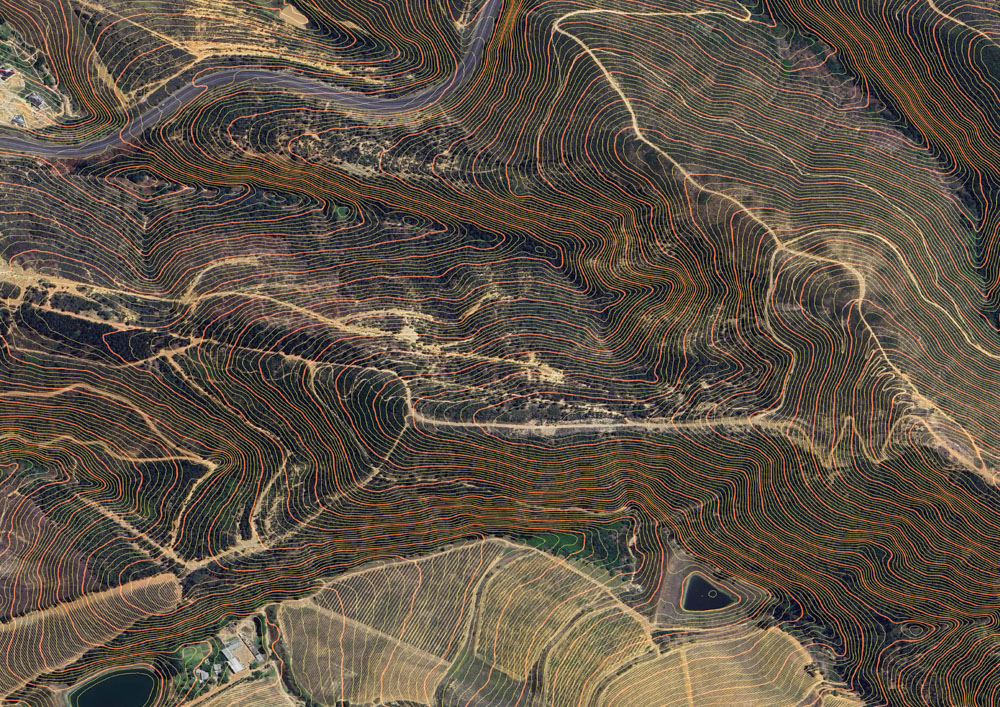
Contours over aerials
Contours
Contours are essential for many applications, including construction planning, hydrological modelling and environmental management. Geosmart Space provides contour data with 50cm vertical interval spacing for anywhere in South Africa. Other intervals (e.g. 1m, 2m, 5m) can also be provided. The contours can be converted to various formats, including those compatible with engineering software such as CAD and ModelBuilder.
